Fort Siloso: Hill 270

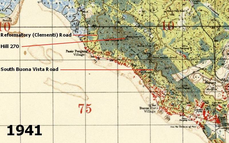
A 1941 map showing hill 270
Hill 270 formed an important element of the coast defences of Singapore. Neatly sandwiched between South Buona Vista Road and Reformatory (now called Clementi) Road, it commanded an excellent view to Blakang Mati in the East and beyond Tanjong Gul to the west. The 270 came from the height of the hill - 270 feet (82·3 metres) above mean sea level.
On Hill 270 a Fortress Observation Post (F.O.P.) was constructed in 1936. This was to serve Faber Fire Command. Also built was the No.2 Battery Observation Post (B.O.P.) for the Buona Vista 15 Inch Battery. The F.O.P. was one of four for Faber Fire Command. Two of the others being on Mount Faber and at Tanjong Gul. The Tanjong Gul post was designated as an Advanced Fortress Observation Post. The fourth F.O.P. was shared with Changi Fire Command. This was situated at Powder Magazine, on the coast road near Bedok Corner.
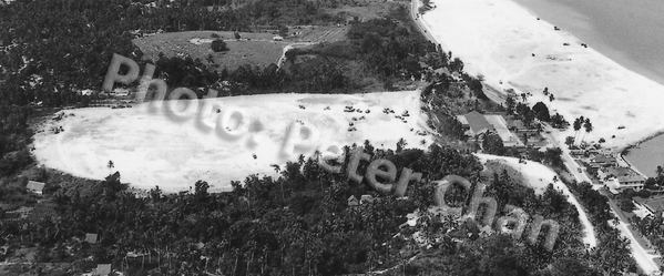
Powder Magazine Area Bedok. 1962.
Ten figure map references place the Hill 270 Posts close to each other. It is likely that there was just the one building serving both. Indeed only one large square building is shown on aerial photos and a post war map. The posts were around 1000 yards (940 metres) from the coastline by Pasir Panjang Road. Neither Post was visible above the skyline, as it was positioned below the top of the hill.
The height of the B.O.P. would have given a distance of approximately 19.5 miles (31.5 k) to the horizon - excluding any corrections for refraction and the curvature of the earth (these will be covered in a future page about Range finding). The range of the Buona Vista Battery was 36,900 yards (33,741 metres), and of Fort Connaught, 29,600 yards (27,066 metres). Lt. Gen. Percival had requested an upgrade of fire control instrumentation to increase the range of the big guns, but I do not know if this was installed before the war with Japan started. Japanese troops advancing towards the town in February 1942, reported a ‘Square Fortress’ in the area. It is probable that they were referring to the Posts as no other building matching he description was in the area.
There has been some dispute as to whether or not there were a B.O.P. and F.O.P. on Hill 270. To clarify, this is from Appendix IV of a report concerning the commissioning of the Buona Vista Battery. "A mast about 30’-0” long was set up vertically at the centre of rotation of the mounting, and a theodolite was set up over the pivot of the P.F. Telescope at the B.O.P., Hill 270 ..............". I also have other references.
Using a Depression Range-Finder
Fort Pierson, Hobart, Australia
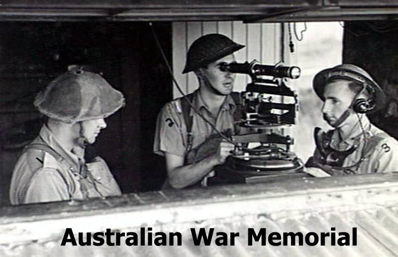
Among the instruments found in Fortress and Battery Observation Posts were; Fortress Position Finder, Time of Flight Indicators, Fall of Shot Indicators, Coast Defence Directors, Range-finders and Plotting Tables. There would also be recognition charts and and Tide Tables. The type of range finder would be either a Depression Range-finder or a Short Horizontal Base Range Finder.
Fortress Observation Posts would provide continuous reports of range and bearing, course and speed of a target to the Fortress Plotting Room. The Posts would also observe and report on fall of shot.
Nothing remains of the two Posts on Hill 270 today. In their place is a large water tank. However, just north of the water tank and somewhat lower down, are the remains of several British military buildings.
These buildings are often visited by the curious and by urban explorers. They are often called ‘The Forgotten (or Lost) Outpost’. Let’s face it, they are neither lost or forgotten. What they are most definitely not is an Outpost.
In military terms, what is an Outpost? I'll quote from a few sources. There are also several definitions that you can easily find using an Internet search engine.
Major-General G.E. Voyle, wrote in his military dictionary in 1876:-
“Outposts. Bodies of troops, chiefly cavalry and infantry, posted beyond the bound or limits of the encampment, to give an army or detachment timely notice of the movements of the enemy, and to guard against surprises”.
Colonel Mcdougal wrote in the ‘Theory of war’:-
"The safety of an army in an enemy’s country materially depends on the manner in which the Outpost duty is performed. The Outposts, pickets, and advanced sentries, are the watch-dogs of the army, whose peculiar business is to detect and give timely warning of the approach of an enemy, as well as every circumstance which may appear to threaten its safety".
Oxford Dictionary:-
“A small military camp or position at some distance from the main army, used especially as a guard against surprise attack”.
Chambers Dictionary:-
“A post or station beyond the main body of the army, etc.; a remote settlement or stronghold”.
To the west of Hill 270 and its buildings was Reformatory Road, and to the east South Buona Vista Road. To the north Ayer Rajah Road, and to the south Pasir Panjang Road. All main roads even in pre-war days. Also to the east was Pasir Laba 6 Inch Battery, and north was Buona Vista 15 Inch Battery. The Naval Base, and other military establishments were further to the north at Sembawang, Woodlands and Kranji. Of course there were the airfields at Tengah and Sembawang to the north as well. So these buildings near Hill 270 were hardly in outpost country, and they were not an outpost.


From their design, the buildings are pre-war British Military accommodation and ancillary buildings such as ablutions, latrines, stores and a cookhouse. They are not built for or sited for defensive purposes. Similar buildings were once seen in many areas of Singapore close to fixed defence positions. Many still can be seen, Mount Serapong, Pulau Ubin, Pulau Sejahat and Pulau Tekong for example.
The F.O.P. and B.O.P. required manning. The purpose of these buildings was to provide accommodation, offices and stores the the men who manned the Posts.
My thanks to Peter Chan, Jerome Lim and Chris Lee for permission to use their photos.
You should visit Jerome’s excellent blog at The Long and Winding Road
Chris keeps a lot of his photos at Krisgage Photos